Peter Madsen Rederi (PM), a Danish company established in 1954, has since 1989 specialized in hydrographical surveying. PM has throughout the years established a great network and knowledge in this area enabling the company to select and manage the right solution for almost any survey operation. PM has also developed their own training program for their hydrographic surveyors and engineers to ensure optimal results and continues to improve and gather new knowledge and techniques. The company is mainly operating in Northern Europe.
PM maintains a fleet of the newest and most accurate equipment in both hardware and software. It currently consists of six dredgers and offshore work vessels equipped with hydraulic backhoe and rope excavators combined with Teledyne PDS Software and three multibeam echosounders, i.e. two SeaBat 7125 SV Systems and one MB1 System.
PM’s operations primarily include work at offshore windfarms, capital and maintenance dredging, pilling works, stone works, diving works, pipe and cable works, as well as video and positioning.
Situation
In the spring of 2014, PM began work on the Little Belt Railway Bridge in Middelfart, Denmark. Due to settlement and scour, the bridge’s geotechnical stability had to be improved, which was done by carefully placing 169,000m3 of rocks within tight tolerances at a water depth of 40 meters. The bridge is a large construction and built using heavy and solid materials. It was therefore almost impossible to receive a strong GPS signal, both during the deployment of rocks and surveying. PM, however, solved this by setting up its own GPS reference station very close to the bridge, installing a GPS receiver on both ends of their vessels, and using Pospac-editing after the completion of the survey. The Pospac-editing allowed them to process the data after collection, and, by combining both virtual and land-based GPS reference stations, guarantee a constant RTK-fixed signal throughout the survey and adjust the collected data accordingly.
During the work at the bridge, daily multibeam echosounder surveys were performed, which allowed them to continually evaluate the work carried out, and thus update and make new deployment files in their Teledyne PDS system. This way they were each morning able to provide feedback to the crane operators about the previous work and the current state of progress.
When submarine work is carried out, trustworthy and accurate data is required, whether it’s before, during, or after construction work. Reliable data is critical in order to check that the construction plan corresponds with reality prior to setting the process in motion, and once in motion, to monitor progress to ensure that the work is performed according to plan and stays within the tolerances.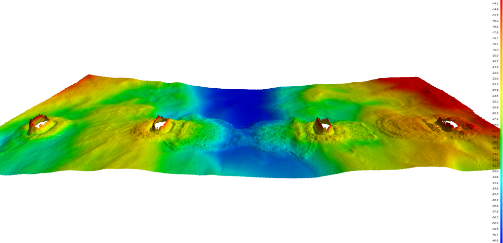
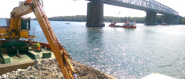
Figure 1 – Survey of seabed during Little Belt Railway Bridge seabed reinforcement
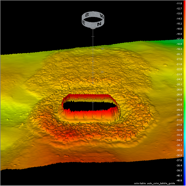
Figure 2 – Stone placement around a pier and between two piers at Little Belt Railway Bridge
Additional tools used during the project
PM has developed a system which combines Teledyne PDS with an underwater video camera. This system has proven to be a great tool when precision performance is needed, as it replaces several expensive diver operations. What’s more, underwater filming gives the most authentic impression of the construction and serves well as handover documentation.
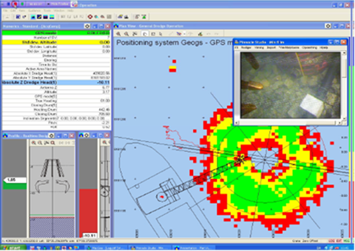
Figure 3 – Combination of Teledyne PDS and underwater filming
Furthermore, PM recognizes that it has a certain maximum capacity and cannot cover all aspects of the technologies and specific requirements for different projects. The company has therefore over the years developed mutually beneficial relationships with other skilled companies capable of delivering products with the same level of quality as PM.
Result
The technological development along with their expertise and training has made PM and their combined fleet very productive and capable of performing construction works at sea with great accuracy and excellent documentation. For example, when PM secured the geotechnical stability at the Little Belt Railway Bridge, the embankments of up to 6 meters in thickness had to be within an accuracy of +/-20cm for the quarry-run rocks, and +80/-40cm for the largest armor rocks at a water depth of 40 meters. The natural layout and flow of the Little Belt area with its inherent extremely strong currents meant that the rocks didn’t always end in the location on the seabed as intended by the vessel crew.
In order to guarantee and improve the rock dumping, PM performed a multibeam echosounder survey of the structure at the end of each day and updated the vessel’s Teledyne PDS system with the newest files. This enabled PM to make “preparation” files on a daily basis ensuring that the accuracy requirements were met and the strong currents given due consideration.
Below are more examples of PM survey projects:
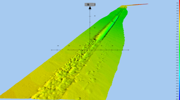
Figure 4 Survey of cable trench
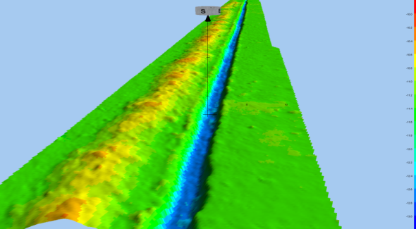
Figure 5 Survey of backfilled cable trench
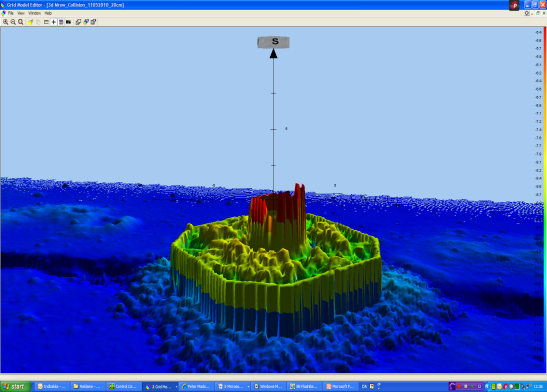
Figure 6 Survey of wind turbine generator foundation
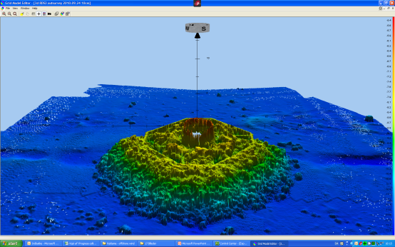
Figure 7 Survey after placement of collision protection
Below are nine examples of handover documentation for previous PM projects:
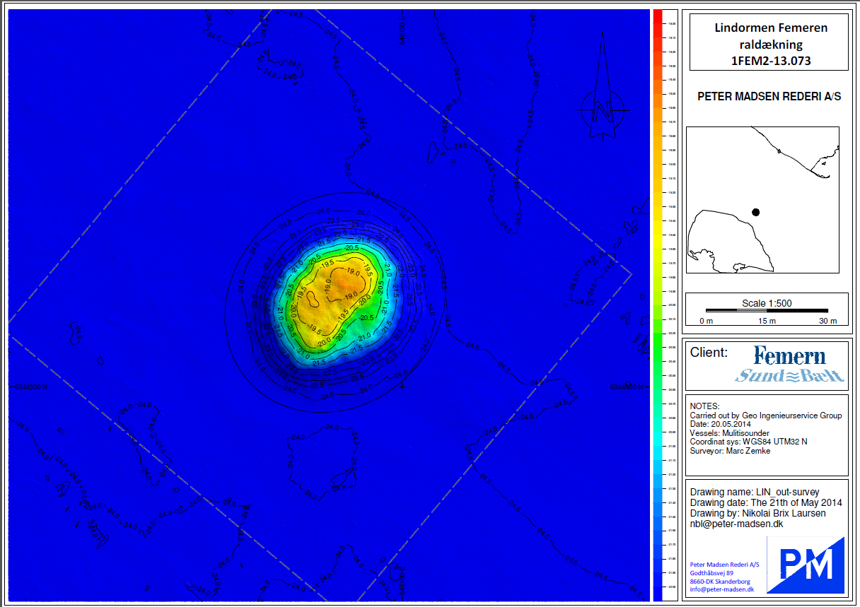
Figure 8 Handover documentation for previous Peder Madsen projects
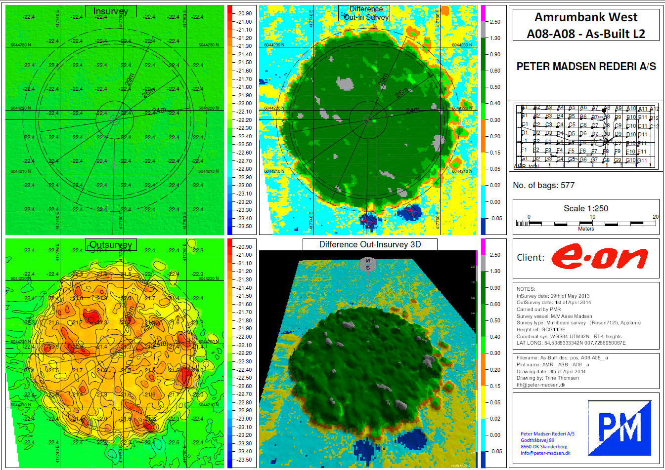
Figure 9 Handover documentation for previous Peder Madsen projects
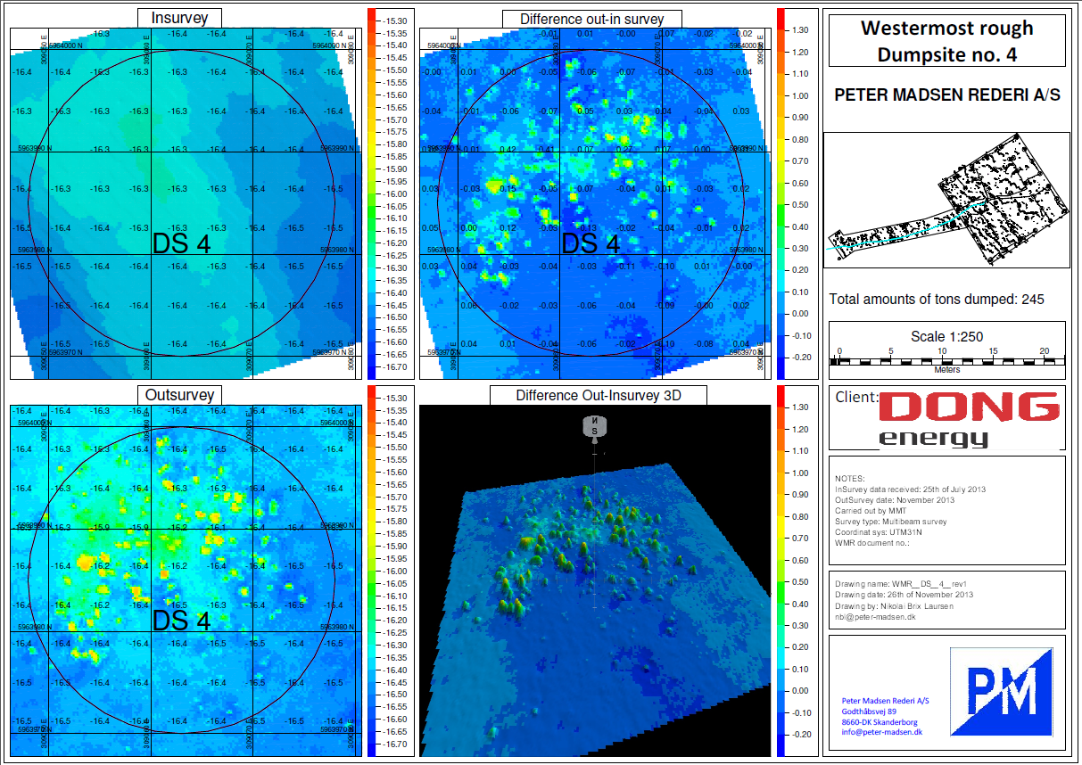 Figure 10 Handover documentation for previous Peder Madsen projects
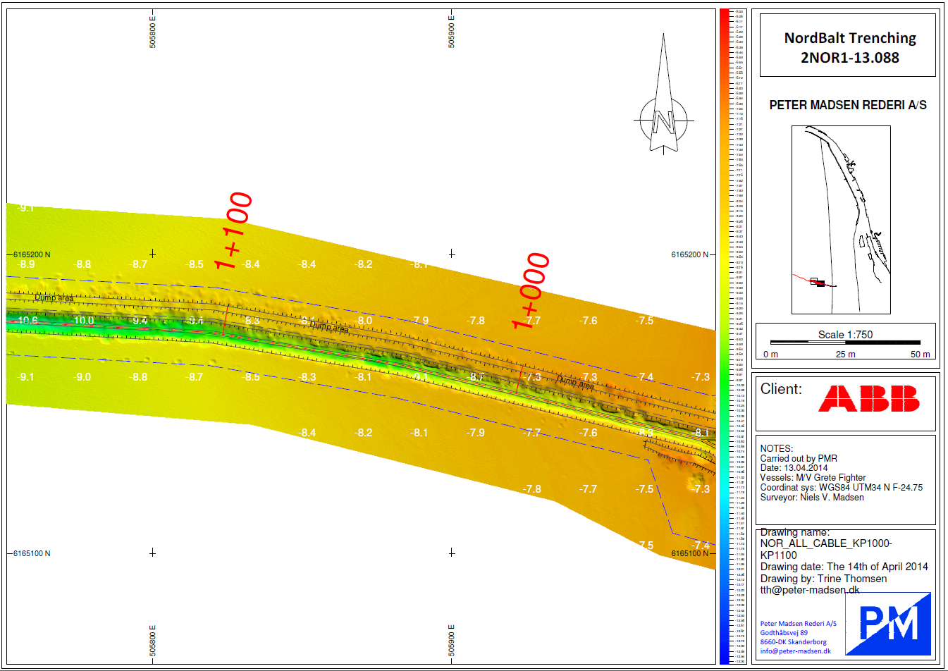
Figure 11 Handover documentation for previous Peder Madsen projects
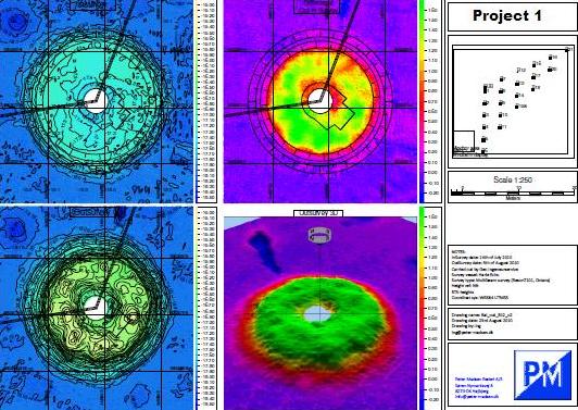
Figure 12 Handover documentation for previous Peder Madsen projects
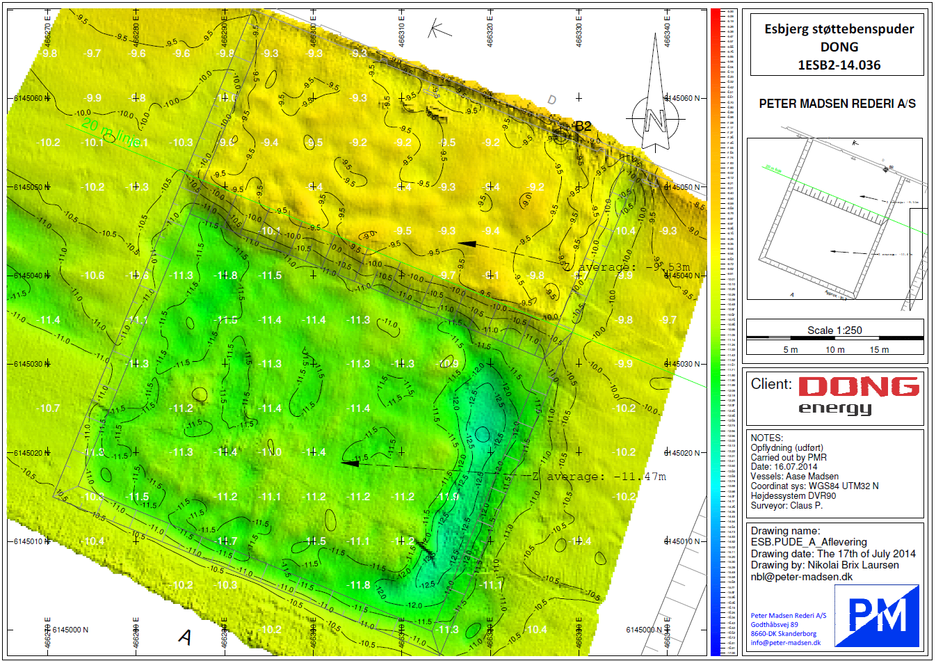 Figure 13 Handover documentation for previous Peder Madsen projects
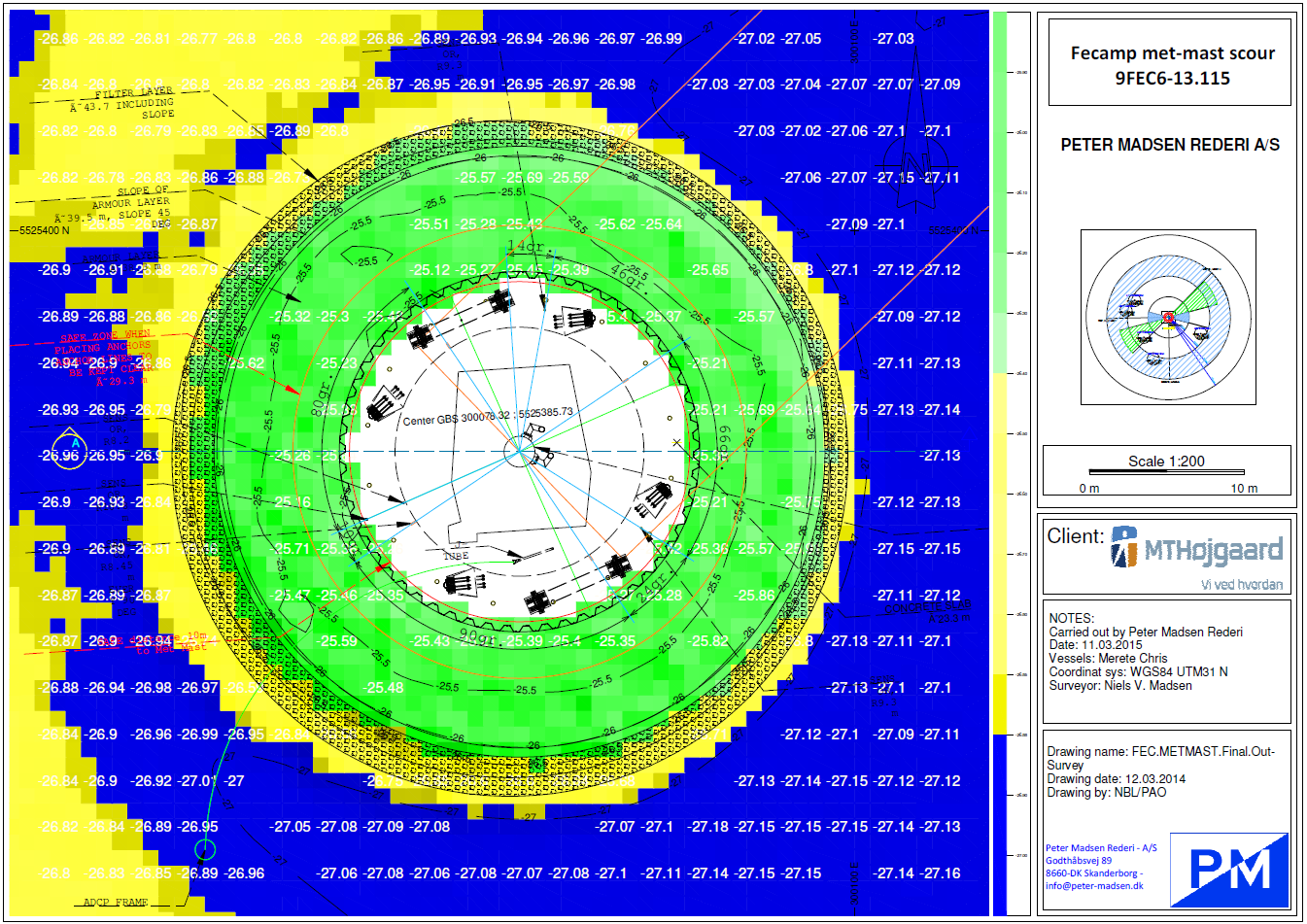
Figure 14 Handover documentation for previous Peder Madsen projects
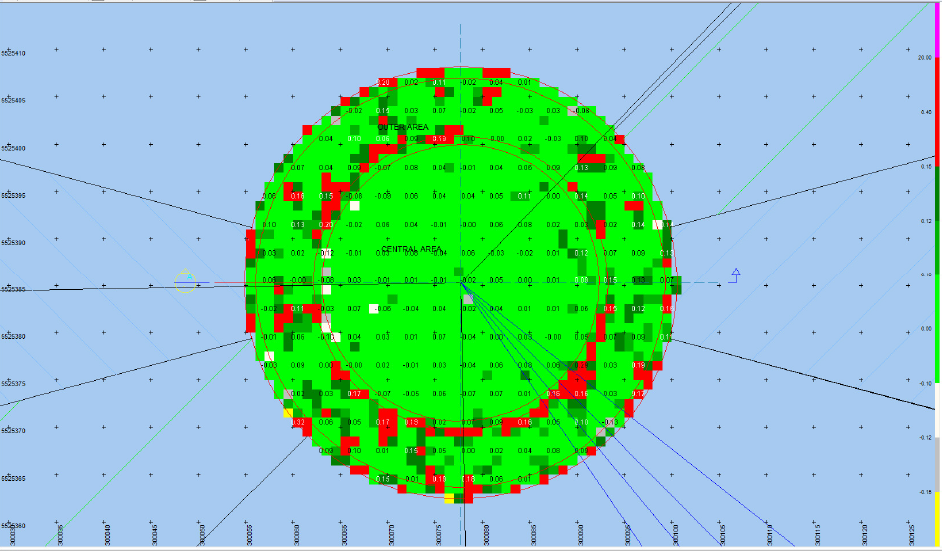
Figure 15 Handover documentation for previous Peder Madsen projects
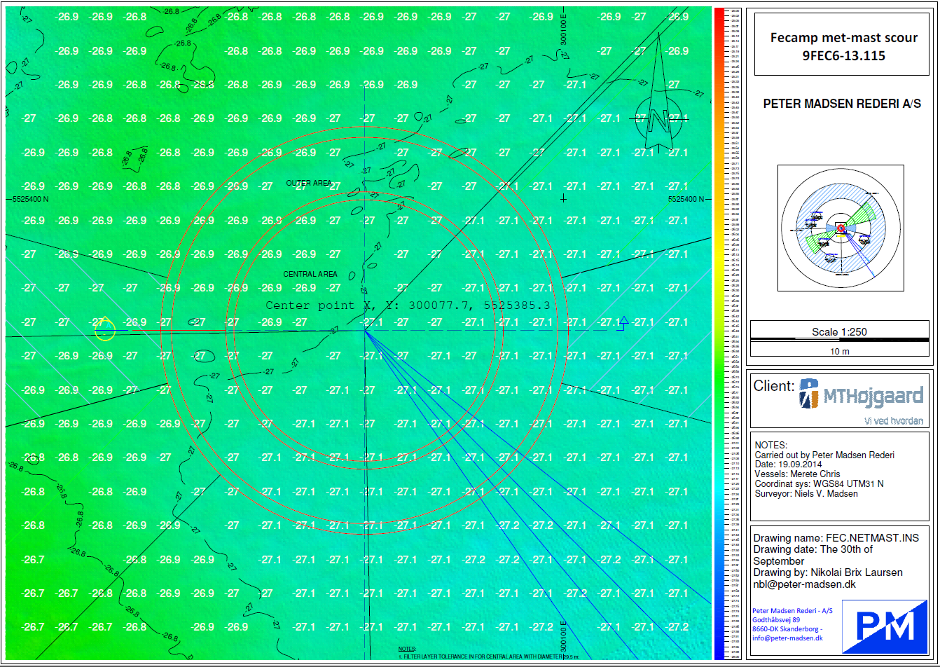
Figure 16 Handover documentation for previous Peder Madsen projects

