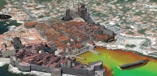
In August 2017 and November 2018, on behalf of the County port authority of Dubrovnik and Institute of Marine Heritage - Ars Nautica, GEOmar conducted survey operations in Dubrovnik Old Town Port with the following objectives:
General mapping of the port and production of bathymetric maps
Investigating the quay wall of the port
Investigating the breakwater “Kaše”
The following give an historical overview and introduces the state of the survey area. Hereafter the challenges of surveying in such an area arepresented, followed by detailed steps of the setup and method used to collect and deliver the products for this project.This case describes how to provide a client with a complete overview of the state of the coastal and underwater part of the structure and the following methods will be described:
Photogrammetric method - drone aerial mapping
Multibeam echosounder
Classical geodetic method such as total station and GNSS
Sub-bottom profiling - in the latter stage of research

