.jpg) Greenland Institute of Natural Resources Uses Teledyne Marine SeaBat T50-ER Multibeam Sonar System to Create High-Resolution Habitat Maps.
Greenland Institute of Natural Resources Uses Teledyne Marine SeaBat T50-ER Multibeam Sonar System to Create High-Resolution Habitat Maps.
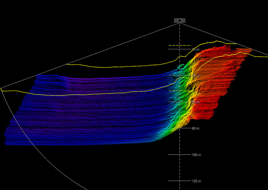
Accurate subsea and seabed mapping is crucial for a wide range of industries, from
offshore energy production to environmental research. Teledyne Marine offers innovative
subsea mapping solutions designed to provide precise, real-time data to support informed decision-making and optimize operations.
Whether you're conducting marine research, inspecting underwater infrastructure, or preparing for offshore developments,
Teledyne Marine's seabed mapping technologies are designed to deliver high-quality results in the most challenging environments.
What is Subsea and Seabed Mapping?
Subsea mapping refers to the process of creating detailed, accurate representations of the underwater environment, including the seabed and the sub-seabed.
This process involves capturing critical data about the underwater topography, depth, geological features, and the condition of existing infrastructure.
Seabed mapping, a subset of subsea mapping, specifically focuses on the structure, composition, and characteristics of the ocean floor.
Teledyne Marine provides
a range of advanced sonar systems, imaging tools, and autonomous underwater vehicles (UUVs) designed to collect and analyze these essential data points.
Our cutting-edge mapping solutions allow for the visualization and analysis of the seabed in both
shallow and
deep-water environments, providing clarity and insight where human access is limited or impossible.
Key Benefits of Subsea and Seabed Mapping Solutions
- High-Resolution Data: Exceptional resolution ensures every seabed feature is captured with precision for reliable assessments.
- Enhanced Safety: Advanced sonar systems and unmanned vehicles minimize risks and improve operational safety.
- Cost-Effectiveness: Faster, efficient data collection reduces costs and enables real-time analysis.
- Advanced Technology for Challenging Environments: Reliable data collection even in deep-sea or complex coastal conditions.
- Comprehensive Mapping Solutions: Integration of various sensors for detailed insights on depth, sediment, marine life, and more.
SeaBat T50-P Bathymetry and Snippets Backscatter data collected at Haltenbanken in the Norwegian Sea, approximately 100 nautical miles Nord of Kristiansund. Visible in both bathymetry and backscatter are the relict ice scours generated by the passage of drifting iceberg keels from ablating glacial ice in 300+ metre water depths.
The multibeam data were collected from seismic vessel Christina E. in parallel with towed electromagnetic survey.
Applications of Subsea and Seabed Mapping
- Offshore Energy Exploration and
Infrastructure: Essential for oil, gas, and renewable energy site surveys and infrastructure integrity.
- Environmental Monitoring and Research: Tracks marine ecosystem changes, biodiversity, pollutants, and sediment movement.
- Port and Harbor Surveys: Ensures safe navigation, dredging assessments, and harbor management.
- Archaeological Investigations: Locates and maps submerged historical artifacts and shipwrecks for excavation.
- Defense and Security: Supports naval reconnaissance, surveillance, underwater defense, and mine detection.
Why Choose Teledyne Marine for Subsea and Seabed Mapping?
Teledyne Marine is a recognized leader in subsea mapping, offering advanced technologies that deliver unmatched accuracy, reliability, and efficiency.
With decades of expertise, our
sonar systems,
autonomous vehicles, and
data processing technologies work in the most challenging underwater environments, providing real-time, actionable data that enhances operational efficiency.
Supported by a global network of technical experts, we are your trusted partner in subsea and seabed mapping.
How to Achieve the Best Sonar Data Every Time
The Teledyne RESON SeaBat T-Series sonars come equipped with a unique set of features designed to help surveyors obtain the highest quality data in the shortest amount of time.
We have listed different scenarios where the SeaBat T-Series' built-in features significantly enhance the data collection. Leare more >

